Earthquake
A large earthquake could occur at any time. Be prepared, have a household, family and work plan and grab bag. DROP, COVER, HOLD and remember if an earthquake is LONG OR STRONG, GET GONE. For more information see: GET READY
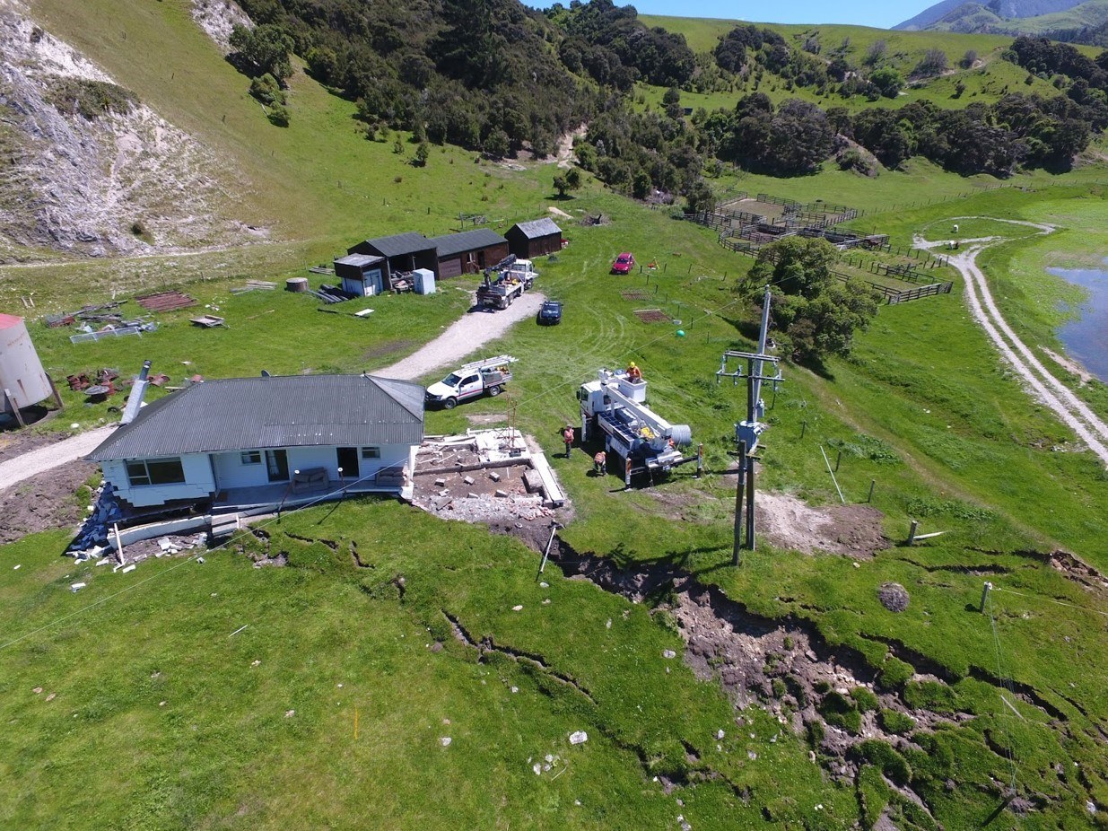
Kekerengu Fault rupture displacing the road and house by ~10 metres at Bluff Station. Photo by Tim Little
Earthquakes
Earthquakes occur when pressure builds along a fault line and is suddenly released, creating shock waves that make the ground shake. This can cause damage to buildings, bridges, and infrastructure that are on or near fault lines. The type and extent of hazards caused by an earthquake depend on the strength of ground shaking and how the earthquake deforms the surrounding land.
Te Tai Poutini faults
The Alpine Fault runs along much of the length of the West Coast region, from Milford Sound all the way up past Hokitika. There is a 75% chance of the Alpine Fault producing an earthquake in the next 50 years, with an 82% chance that this will be greater than magnitude 8. When this happens, the landscape could be offset by up to 9 metres sideways and 2m vertically. Places closest to the fault will feel the strongest shaking and experience the greatest impacts. There is a high likelihood that the West Coast will be isolated for weeks to months following an AF8 rupture. Find out more about AF8 here.
Papatea Fault surface rupture, 2016 Kaikoura Earthquake.
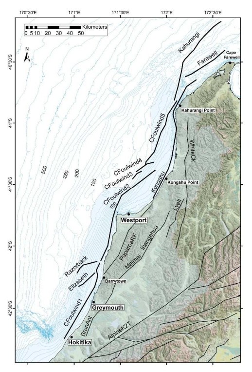
Aside from the Alpine Fault, the West Coast region contains numerous smaller faults, such as the Glasgow, Inangahua and Buller faults. These faults move much less frequently and produce smaller earthquakes compared to the Alpine Fault, but they can still cause destructive local shaking. The GNS Active Faults database can be found here.
In any given year you are more likely to experience shaking from faults out of the region and smaller faults on the West Coast than the Alpine Fault due to the high number of small faults across the motu.
The Alpine Fault mapping report can be found here.
Offshore Faults on West Coast from Hokitika to Cape Farewell
Te Tai Poutini offshore faults
Rather than running across the landscape, these faults are located on the seabed, at some distance from the coastline. Examples include the Cape Foulwind Fault, about 10km offshore from Westport, but also running as far north as Kahurangi Point, and as far south as Hokitika. This and several other faults out to sea can cause big earthquakes. Even though these quakes don’t happen often, when they do, they can be strong and might also create a Tsunami or strong waves. If you feel an earthquake that is LONG or STRONG, GET GONE.
NIWAs report on offshore faulting can be found here.
Liquefaction
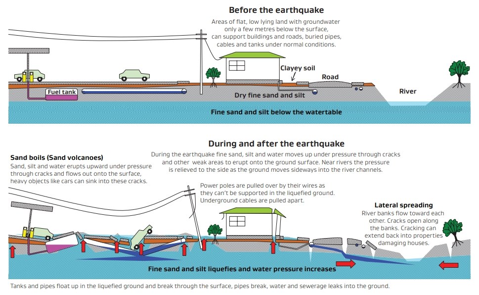
In some parts of the West Coast (like Greymouth, Hokitika, and Westport), the ground is sandy or silty and close to rivers. During a strong earthquake, this lose ground can turn to liquid for a short time. This is called “liquefaction.” When this happens, buildings and roads can sink or tilt, and water can bubble up through the ground. Liquefaction is more likely where the soil is soft and wet (where the water table is high), so areas near river mouths or on old floodplains are most at risk. In addition, areas where land has been reclaimed are often at particularly high risk from liquefaction.
Areas near riverbanks are more likely to experience lateral spreading (where riverbanks slump towards each other). This can increase flood risk following an earthquake as the stopbanks along rivers may become damaged such as the Avon/ Otakaro River in the Christchurch Earthquakes resulting in the Red Zone.
The West Coast Regional Liquefaction Assessment can be found here.
Liquefaction processes and its effects. MBIE, MfE and EQC (2017) - sourced from IPENZ.
Past earthquakes
Several large earthquakes have shaken the West Coast in the past.
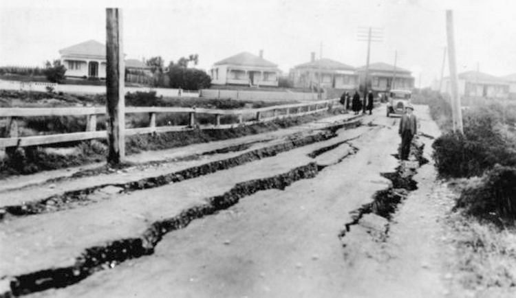
- In 1929, the Buller Earthquake occurred near Murchison. It caused major landslides and damage across the region with 15 casualties. This led to damaging intensities as far away as Greymouth (see image below).
1929 Buller/ Murchison Earthquake impacts in Greymouth. Photo from: West Coast Historical and Mechanical Society.
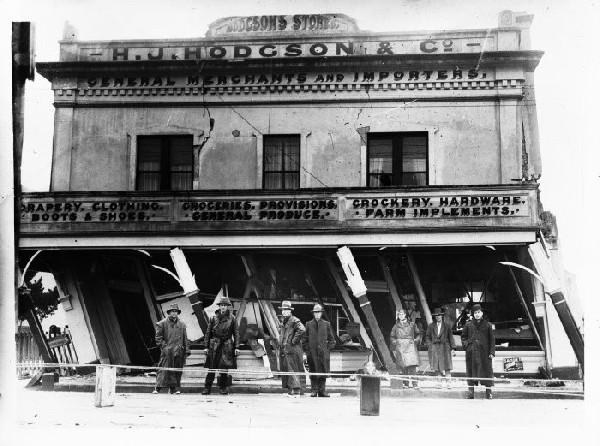
1929 Buller/ Murchison Earthquake impacts in Murchison. Photo from Negatives of the Nelson district.
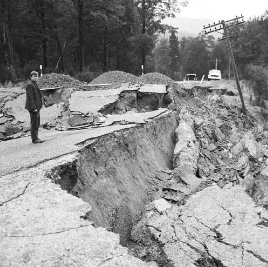
- In 1968, another large earthquake struck at Inangahua, damaging buildings there and in Westport, and causing landslides and liquefaction.
For more information on the Inangahua Earthquake, see Inangahua Earthquake Video, 50 years on.
1968 Inangahua Earthquake damage to roading. Photo from GNS Science.
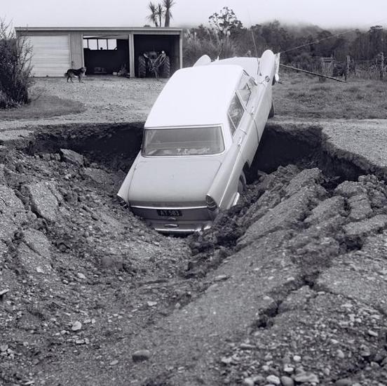
1968 Inangahua Earthquake liquified car. Photo from GNS Science
Further information
Our Natural Hazards Portal displays seismic hazard information including active faults, regional liquefaction susceptibility and historic liquefaction cases. For any further information, please contact naturalhazards@wcrc.govt.nz.