Tsunami
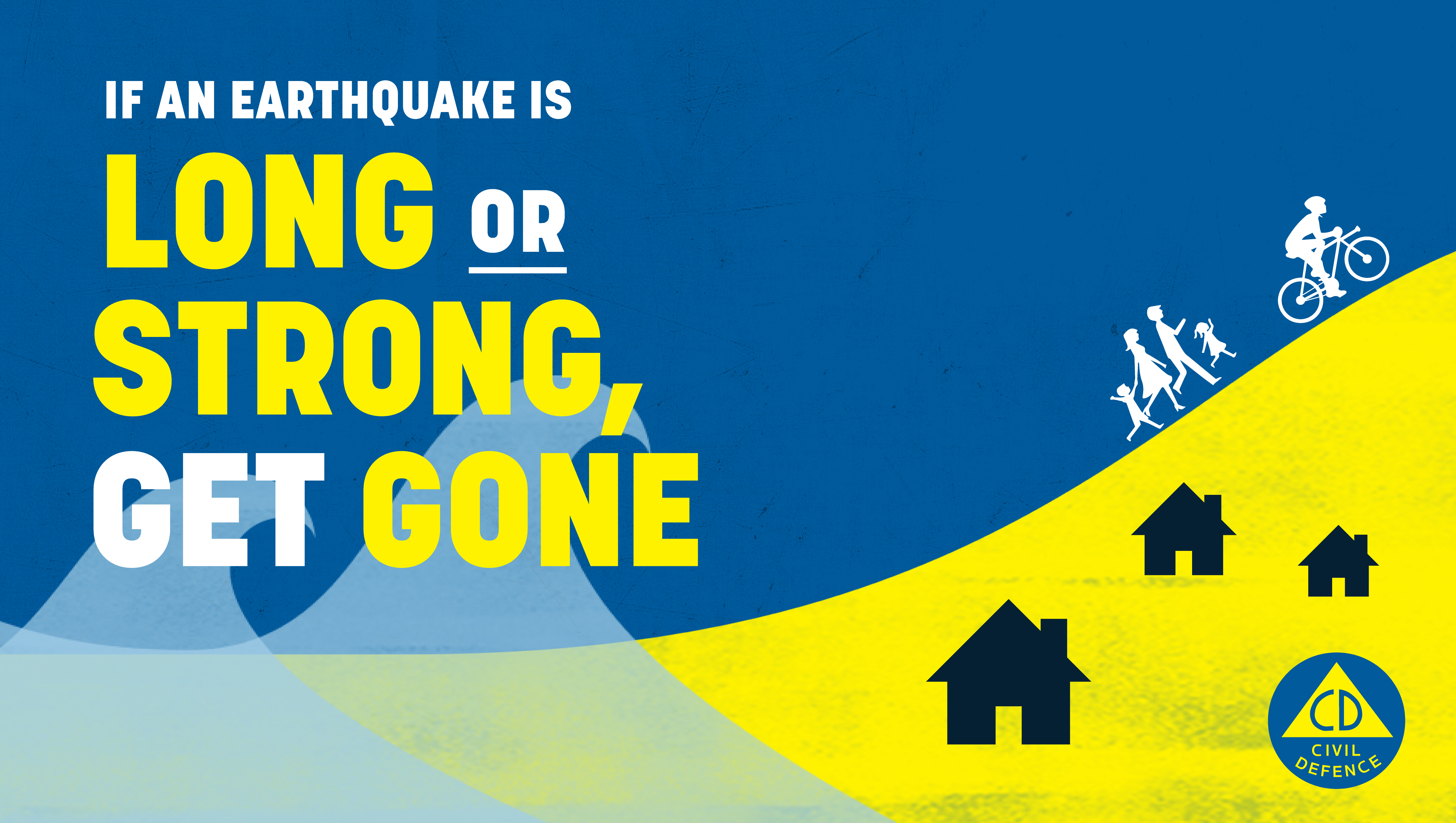
If you are in the mapped red orange or yellow zones and feel a long or strong earthquake, move to higher ground immediately or as far inland as possible, do not wait for an official warning. Walk, run or bike where possible to avoid traffic congestion, remain in place until an official all clear is given.
National Tsunami information can be found here.
West Coast tsunami evacuation zones can be found here.
West Coast and tsunami
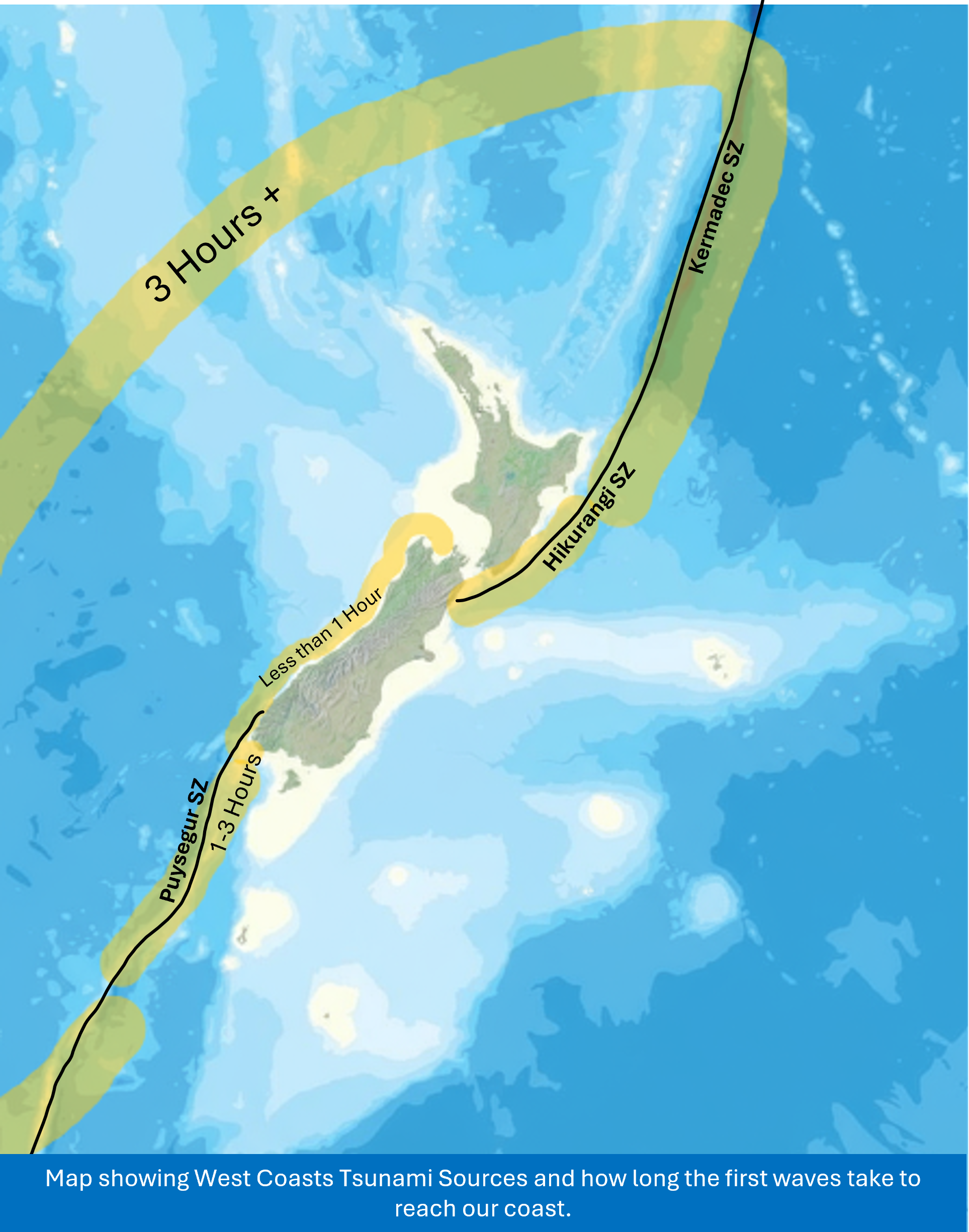
Tai Poutini is exposed to coastal tsunami hazards from both near and distant source tsunami. Modelling of many different tsunami-producing earthquake events has allowed us to map the parts of our coastline likely to be impacted by different near- and distant-source tsunamis. For evacuation purposes these are broken down into zones – red has highest likelihood of experiencing any tsunami, while yellow is likely to be affected only by the largest tsunami event.
Distal source - over three hours to impact
A distant source tsunami, like one generated from Chile/ Peru Subduction Zone, could take 14 hours or more to arrive. In these cases, you will receive an official warning message via emergency mobile alert on your phone, WCEM/ WCRC/ TA social media, RNZ radio/ television, or via emergency response personnel.
Regional source – one to three hours to impact
A regional source tsunami could take between one and three hours to arrive. You may receive an official warning message via emergency mobile alert on your phone, WCEM/ WCRC/ TA social media, RNZ radio/ television, or via emergency response personnel. As always, if you feel a long or strong earthquake, get gone.
Local source – less than one hour to impact
A local source tsunami generated from a local offshore earthquake (for example, the Cape Foulwind Fault or Puysegur Subduction Zone), can arrive at coastal areas within minutes. In this case, official warnings are unlikely to be issued before damaging waves arrive, so people in coastal areas need to take immediate action. If you feel an earthquake that makes it hard to stand or lasts more than a minute – move immediately to higher ground or as far inland as possible.
How a tsunami happens
A tsunami is a series of long, powerful waves, involving the whole depth of the ocean, carrying a lot of energy. Normal ocean waves are created by the wind, are relatively short in length and involve only the top few meters of the ocean.
Generation: A tsunami starts when a large amount of water is suddenly moved, normally by an earthquake under the ocean.
Diagram showing generation of a tsunami, adapted from Bay of Plenty Regional Council.
Propagation: The waves spread out in all directions from where the earthquake happened. The waves travel away from the earthquake site at speeds up to 800km/h. Far out at sea, the wavelength (distance from crest to crest) may be very long (hundreds of kilometers). In the open ocean tsunami waves may not be noticeable as the top of the wave may only reach one metre or less above the normal swell height.
Diagram showing propagation of a tsunami, adapted from Bay of Plenty Regional Council.
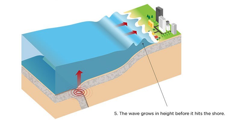
Amplification: As the waves get closer to the shore and the sea becomes shallower, the wave height gets bigger, and the wavelength shortens. This means the waves are closer together and much bigger. The wave speed slows down to 30-50km/h. The ocean recedes from the coast as the water is drawn back to feed the incoming wave.
Diagram showing amplification of a tsunami, adapted from Bay of Plenty Regional Council.
Inundation (run-up): The tsunami hits the shoreline. Run-up means how far inland the water travels. The tsunami may come onshore like a fast-rising flood, or a wall of turbulent water, and can flood low-lying coastal areas for many kilometers inland. Most tsunami are less than 3m high, however extreme cases show tsunami waves can be over 30m tall where they inundate land near their source. Tsunami waves are typically not a single wave but generally occur in a series of waves which may last from minutes to hours.
Ground effects: 15cm of fast-moving water can knock adults off their feet and 30cm depth can carry away small cars. Tsunami can be very destructive due to their speed and volume (the amount of water). They ae very dangerous as the waves return to the sea taking debris with them.
Impacts on the built environment: Large tsunami pose great threat to human life, properties, infrastructure and economies. Tsunami normally cause the most damage when the coastline affected is close to the earthquake source, however large tsunami can reach shorelines far away and cause large amounts of damage.
Remember: LONG OR STRONG, GET GONE.
Example of landslide driven lake tsunami. This image was produced using AI (Perplexity).
Lake tsunami/seiches
Tsunamis can happen on lakes at any time, if you are near a lake and feel a long or strong earthquake, get gone!
A tsunami would cause lake levels to rise and fall rapidly. Staying out of the water and away from the shore can save lives and reduce the load of emergency responders after a big earthquake.
There are three ways a tsunami could be generated on a lake:
- Collapse of the underwater sand and gravels (the delta) at the heads of lakes, most likely caused by an earthquake.
- A landslide into a lake, caused by an earthquake or heavy rainfall/ other mass movement. Many of our lakes have steep slopes near them.
- Shaking or tilting of the lakebed as earthquake waves pass through them from nearby or distant large earthquakes. This can also cause water in lakes to ‘slosh’ back and forth, also known as a seiche (pronounced ‘saysh’).
Even if a tsunami in the lake does not flood land, it may still cause dangerous surges on the lake shore, so it is important to move away from the lake shore if you feel a long or strong earthquake.
Historic lake tsunami
Lake Brunner/ Moana experienced a lake tsunami on 17 June 1929. This was caused by the magnitude 7.3 Murchison Earthquake. During this event the centre of the lake was observed to fall rapidly, with the remaining water then falling into that gap, creating a large column of water to shoot into the air, creating waves of sorts normally seen in a big storm. The Department of Conservation undertook a review of historic seiche events between 1846 and 2022 – click here to access the report.
Technical reports
For more information about the West Coast’s offshore faults, and tsunami modelling completed for our region, check out the below reports:
- Offshore faulting and earthquake sources can be found here.
- Tsunami evacuation zone boundary mapping the West Coast region can be found here.
- Tsunami evacuation zones for West Coast can be found here.
For any further information, please contact: naturalhazards@wcrc.govt.nz.